

Thermal Drone Inspections in Miami & South Florida
Where aerial thermal data is useful, what it can reveal, and how field conditions affect inspection quality.
Read InsightDrone Inspection Services · South Florida
Professional visual, infrared, thermal, and RTK-enabled drone inspection support for telecom, utilities, commercial roofs, solar assets, façades, buildings, and infrastructure across Miami-Dade, Broward, Palm Beach, the Florida Keys, and South Florida.
Inspection Capabilities
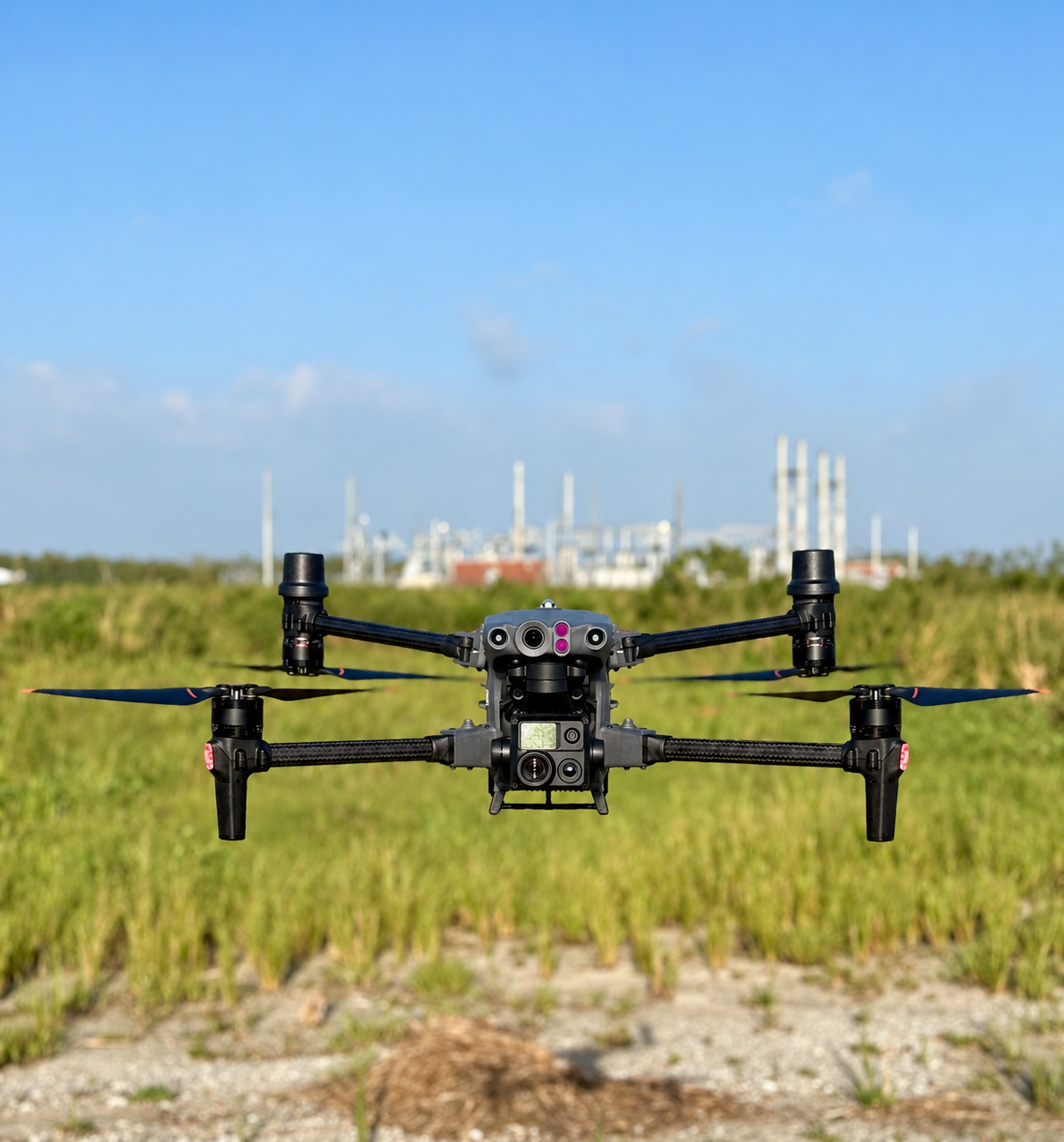
SAIRS combines high-resolution visual documentation, infrared and thermal imaging, RTK-enabled capture, and site-specific flight planning to help teams inspect difficult, elevated, and access-limited assets more efficiently.

Aerial and civil inspection support for cell towers, rooftop telecom sites, antennas, mounts, cabinets, shelters, and compound conditions while reducing unnecessary climbing and elevated access.

Visual and thermal drone inspections for transmission corridors, distribution poles, vegetation encroachment, storm assessment, access roads, and electrical infrastructure.

Infrared and thermal capture for buildings, roofs, solar assets, utilities, and industrial facilities to help document abnormal heat patterns, moisture concerns, electrical issues, and temperature anomalies.

Detailed aerial documentation of roofs, façades, exteriors, drainage areas, HVAC equipment, and visible damage for property managers, contractors, engineers, and insurance documentation.

Thermal and visual drone inspections for solar installations to help operators document hotspots, damaged modules, underperforming panels, and field-level conditions more efficiently.
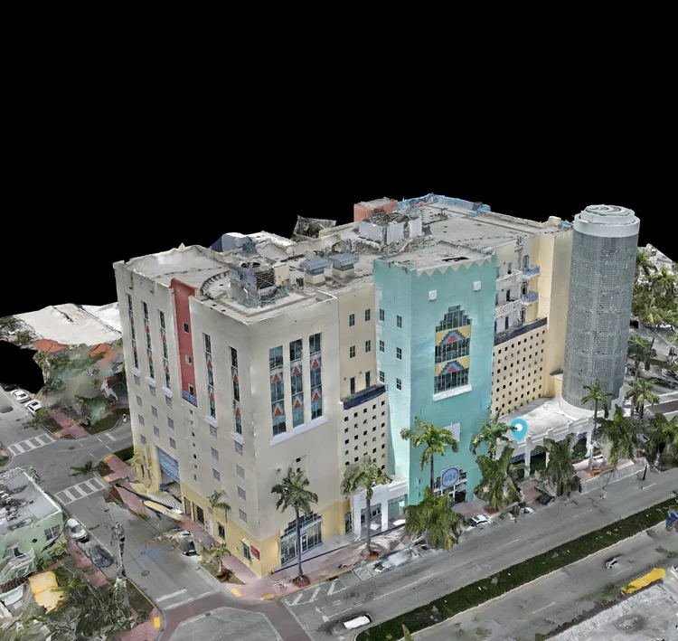
Visual inspection support for building façades, exterior walls, structural details, difficult elevations, and documentation requirements for engineers, property managers, and construction teams.
Inspection Insights
Practical guides and field perspectives from SAIRS inspection work across Miami-Dade, Broward, Palm Beach, and South Florida — covering thermal imaging, commercial roofs, powerline documentation, telecom towers, and technical aerial capture.
Where aerial thermal data is useful, what it can reveal, and how field conditions affect inspection quality.
Read Insight
How aerial thermal capture supports commercial roof documentation and where field conditions matter.
Read Insight
Visual and thermal aerial documentation for transmission and distribution assets, corridors, and field conditions.
Read Insight
What aerial inspection can document across towers, rooftop sites, antennas, mounts, compounds, and equipment.
Read InsightCommercial Property Inspections
SAIRS supports property managers, facility teams, engineers, contractors, and building owners with aerial inspection data for roofs, façades, HVAC areas, exterior conditions, storm damage, thermal anomalies, and recurring property documentation across Miami and South Florida.
Capture roofs, drainage areas, parapets, façades, exterior walls, and difficult elevations without relying only on manual access.
Document rooftop equipment, exterior systems, visible deterioration, access constraints, and property conditions from consistent aerial perspectives.
Add thermal or infrared capture when the project requires documentation of temperature patterns, roof concerns, electrical assets, or building conditions.
Create repeatable visual records for maintenance planning, construction progress, storm response, vendor coordination, and portfolio documentation.
Why SAIRS
Our inspection work is built around practical deliverables: clear imagery, organized project data, efficient field capture, and inspection workflows designed to reduce unnecessary access risk while improving visibility across the asset.
Inspection Workflow
Every drone inspection begins with the asset, location, access conditions, safety requirements, airspace, and the visual, infrared, thermal, mapping, or documentation data required by your team.
We review the asset type, location, access notes, inspection objectives, capture requirements, and expected deliverables.
We confirm airspace, safety considerations, weather, site access, and the appropriate drone platform and sensors for the mission.
We capture visual, infrared, thermal, mapping, or inspection imagery according to the approved project scope.
Project data is organized and delivered through a clear workflow for review, documentation, maintenance planning, or further technical analysis.
Industries Served
Cell towers, rooftop telecom assets, antennas, shelters, compounds, equipment documentation, and visual condition capture.
Powerlines, distribution poles, transmission infrastructure, vegetation areas, solar farms, and electrical asset documentation.
Commercial roofs, façades, exterior envelopes, progress documentation, access-limited areas, and visible damage assessment.
2D maps, 3D models, site documentation, progress data, RTK capture, and photogrammetry support for technical teams.
Frequently Asked Questions
Drones help document elevated, hard-to-reach, or access-limited areas such as tower mounts, rooftops, façades, solar panels, utility corridors, drainage zones, HVAC areas, and visible exterior damage.
Infrared and thermal capture supports roof, solar, utility, electrical, and building inspections where temperature patterns, moisture concerns, insulation issues, electrical anomalies, or abnormal heat signatures may need review.
Yes. SAIRS provides drone inspection services across Miami-Dade, Broward, Palm Beach, the Florida Keys, and surrounding South Florida locations, subject to site access, airspace, weather, and project requirements.
Yes. SAIRS supports property managers, facility teams, contractors, engineers, and building owners with aerial documentation of roofs, façades, HVAC areas, exterior conditions, storm damage, and recurring property conditions.
Inspection files can be organized by asset, flight type, location, visual data, thermal data, mapping outputs, and reference folders so managers, engineers, contractors, or technical teams can review the scope clearly.
Aerial inspection can reduce unnecessary climbing, roof access, lift equipment, and time spent in difficult areas while improving visual coverage for teams responsible for documentation, maintenance, and decision-making.
Timing depends on the asset, project scope, site access, airspace, and weather conditions. Scope review and flight planning are completed before field capture so the mission can be executed efficiently once the site is ready.
Yes. SAIRS operates under FAA Part 107 certification, with missions planned around applicable airspace requirements, flight safety procedures, site conditions, and project-specific risks.
Send us the asset type, location, timeline, inspection objective, and required deliverables. SAIRS will review the scope and recommend the appropriate visual, infrared, thermal, mapping, or aerial documentation workflow for your project.
