
We started in the sky
Built for precise documentation, visual clarity, and reliable project delivery across South Florida.
SAIRS is a South Florida company built to document properties, infrastructure, and commercial assets through aerial imaging, ground-level visuals, Matterport 3D scanning, mapping, thermal analysis, and inspection-focused workflows.
Through SAIRS and SAIRS Axis, we connect technical documentation with professional visual production, helping clients capture real-world spaces with clarity, accuracy, and a clean delivery experience.
Built around solutions, not equipment
SAIRS was never built to be just a drone company. While aerial operations were where the journey began, the vision quickly evolved into something broader: creating a company capable of documenting, inspecting, scanning, and presenting properties, infrastructure, and commercial assets from every perspective.
SAIRS provides technical documentation and field services for infrastructure, telecom, powerlines, roofs, solar assets, mapping, thermal analysis, and inspection environments where accuracy matters. SAIRS Axis focuses on real estate visuals, Matterport 3D tours, cinematic content, hospitality media, commercial visuals, and property marketing deliverables.
Whether the objective is documenting critical infrastructure, creating a digital twin of a property, supporting asset management, or producing content that drives marketing and sales, our mission remains the same: deliver accurate information, exceptional visuals, and a professional experience from start to finish.
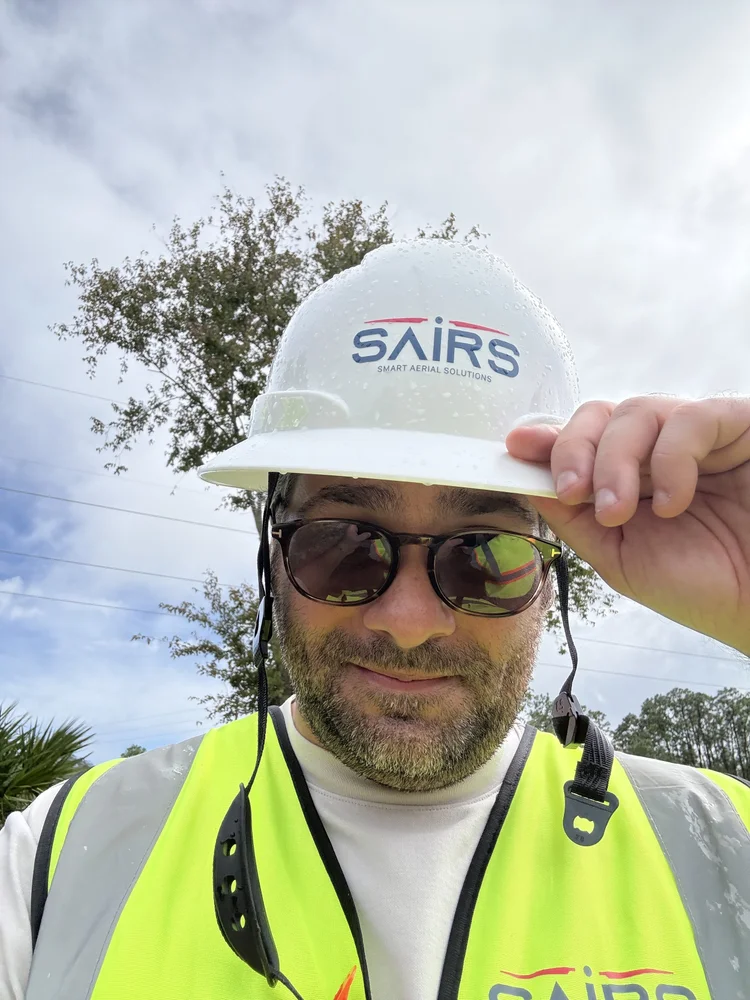
A complete visual and inspection partner
SAIRS combines technical accuracy, professional visual production, and organized delivery through one company structure and one dedicated visual division: SAIRS Axis.
SAIRS
Technical documentation for infrastructure, roofs, telecom, powerlines, solar, mapping, thermal analysis, and inspection environments where accuracy matters.
SAIRS Axis
Real estate visuals, Matterport 3D tours, aerial media, cinematic content, hospitality visuals, and commercial production designed to make properties stand out.
One Standard
Every project is handled with in-house production, organized delivery, reliable communication, and a commitment to precision from capture to final result.
The right tool for every mission
From aerial platforms and thermal systems to LiDAR-based 3D scanning and ground-level cinematic gear, SAIRS is equipped to document every angle with purpose.
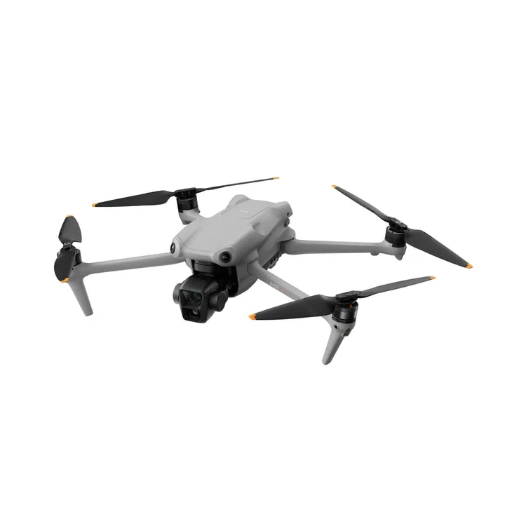
DJI Air 3
Our go-to creative aerial platform for real estate, commercial media, and cinematic visual production.
- Dual-camera system for flexible aerial coverage
- Reliable obstacle sensing for complex environments
- Built for sharp imagery in changing light

Mavic 3 Enterprise RTK
Precision mapping and surveying drone built for data-grade deliverables and accurate aerial documentation.
- RTK module for centimeter-level positioning
- Mechanical shutter for distortion-free mapping
- 4/3 CMOS sensor for high-quality capture
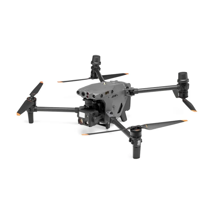
Matrice 30T
Heavy-duty inspection platform for demanding environments where precision and reliability are essential.
- Integrated thermal, zoom, and wide camera system
- Weather-resistant platform for field operations
- Optical zoom for detailed remote assessment

Matterport Pro3
Our 3D scanning system for fast, accurate, immersive digital twins of real spaces.
- LiDAR precision that performs in direct sunlight
- Rapid full-scan capture in seconds
- High-resolution optics for detailed walkthroughs
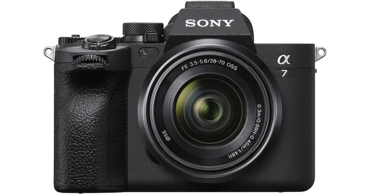
Sony A7 V + DJI RS 5
Our ground-level cinematic setup for premium real estate, hospitality, and commercial content.
- Full-frame sensor for exceptional detail
- Sony FE PZ 16–35mm f/4 G lens
- DJI RS 5 gimbal for fluid motion control
Professional, certified, and insured
SAIRS operates with the structure, safety, and documentation standards expected from a professional visual solutions and technical inspection partner.
Understanding SAIRS and SAIRS Axis
Clear answers about how the company is structured and how we support both technical documentation and visual production projects.
Why was SAIRS created?
SAIRS was created to give clients a more complete way to document real-world spaces. The company began with aerial operations and evolved into a broader visual solutions and technical documentation platform.
What makes SAIRS different from a typical drone company?
SAIRS is not limited to drone capture. We combine aerial imaging, ground-level visuals, 3D scanning, mapping, thermal analysis, inspection workflows, and organized delivery.
What is the difference between SAIRS and SAIRS Axis?
SAIRS focuses on technical documentation, drone inspections, mapping, thermal analysis, infrastructure, telecom, roofs, solar, and inspection-driven work. SAIRS Axis focuses on real estate photography, Matterport tours, aerial media, hospitality visuals, cinematic content, and property marketing.
Can SAIRS support both marketing and technical documentation?
Yes. Some projects require visual presentation, while others require inspection data, asset documentation, or mapping. SAIRS is structured to support both sides depending on the project objective.
How does SAIRS deliver completed projects?
SAIRS organizes completed work through a clean delivery process that may include edited media, inspection files, Matterport links, floor plans, maps, reports, raw files, or project folders depending on the scope.
Where does SAIRS operate?
SAIRS is based in South Florida and serves Miami-Dade, Broward, Palm Beach, and the Florida Keys. We also travel across Florida for special projects.
Ready to capture what matters
Tell us what you need to document, inspect, scan, or present. We’ll help you choose the right approach.
